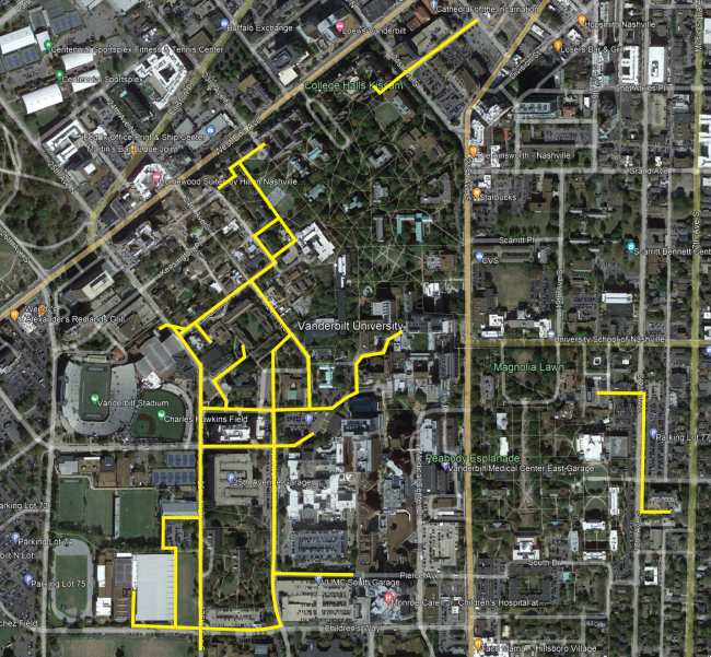
As part of a project to survey Vanderbilt University’s utilities, drone flights are scheduled Nov. 20–24 throughout campus (see map below). The flights are expected to occur daily from 8 a.m. to 5 p.m.
The drone will take video and photographs of the ground to properly map the utilities in a given campus area and will be supervised at all times by at least two licensed drone pilots.
To ensure the safety of the Vanderbilt and surrounding communities, an automatic return-to-home function is set if the drone experiences loss of signal, low battery or a pilot-initiated event. The drone is also equipped with a parachute and a strobe light and will not fly over any moving vehicles.
The flights have been coordinated with and approved by the Vanderbilt University Police Department, Vanderbilt LifeFlight and the university’s Facilities Review Committee.
For questions or concerns, email the Campus Planning and Construction project at constr_alerts@vanderbilt.edu, or use the construction form.
