Vanderbilt Earth scientists have received funding from NASA to use satellite imagery to examine underwater volcanic eruptions’ ripple effect on the planet’s atmospheric processes.
According to Kristen Fauria, assistant professor of Earth and environmental sciences, more than 80 percent of volcanic eruptions occur in the oceans. Despite their significant impact on the environment, she said, they are disproportionately understudied.
During an eruption, plumes of ash and toxic sulfur dioxide can spew into the sky. Afterward, rafts of pumice—floating volcanic rock—can drift over the water’s surface, disturbing the atmosphere and affecting marine life. Underwater, molten lava can heat nutrient-rich water from the seafloor, allowing them to rise toward the surface. This creates a breeding ground for phytoplankton proliferation—as was seen during the 2018 eruption of the Kilauea volcano.


Over the next three years, Fauria and Ralf Bennartz, professor of Earth and environmental sciences, are going to catalog eruptions from shallow (less than 1,500 meters below sea level) submarine volcanoes that have been active over the past 20 years and match those eruptions to associated ash and sulfur dioxide atmospheric signals. “With this information and assessment of submarine eruption frequency and style, we will be able to develop conclusions of the effects of underwater volcanoes on cloud formation and radiative effects,” Bennartz said.
To find submerged volcanoes, Fauria and Bennartz will work with time series data from NASA’s Moderate Resolution Imaging Spectroradiometer and Visible Infrared Imaging Radiometer Suite instruments. These tools capture and refine images of the Earth’s surface every one to two days in a resolution of one-kilometer bands. To process approximately 14,000 sets of images, the researchers will develop semi-automated algorithms to identify discoloration in the ocean and plumes of ash and sulfur dioxide that indicate an eruption. They will also look for increases in clouds’ sulfur dioxide levels to gauge the eruptions’ occurrence and impact.
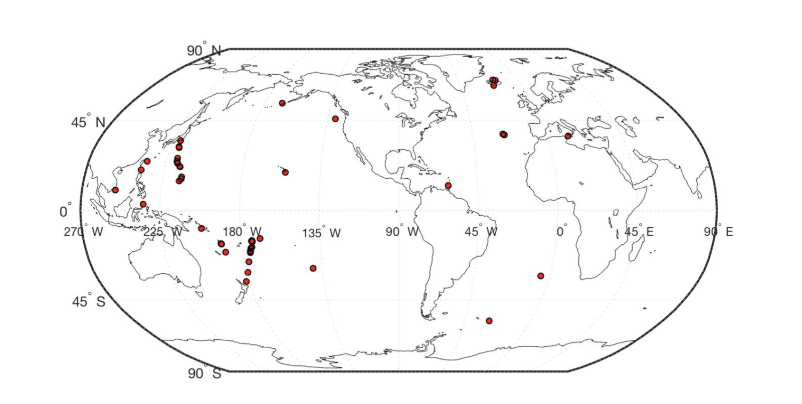
Submarine volcanic eruptions are so difficult to study that fewer than 100 of them have been recorded since 1980. Because they are far from land, and seismic detectors on the ocean floor are often not dense enough to detect or locate activity, researchers have relied on a combination of research cruises, heavy planning and luck to see these eruptions as they are happening. This project is the first to use satellite data for this purpose.
“Because relatively few submarine eruptions are identified and studied, there is a lot to learn about the impacts of these eruptions on atmospheric processes. Our understanding of the spectrum of volcanic activity on Earth is also biased by the lack of observations in the ocean basins. We plan to improve our understanding using remote sensing and with our interdisciplinary team,” said Fauria, the principal investigator on the project.