
A pair of international, collaborative online platforms led by Steven Wernke, associate professor of anthropology, along with Parker VanValkenburgh at Brown University, and Akira Saito at Japan’s National Museum of Ethnology, are leveraging big data to produce a new perspective on the Inka Empire and the Spanish invasion of the Andean region of South America.
Funded by the American Council of Learned Societies and the National Endowment for the Humanities, the large-scale perspectives that these platforms provide have yielded insights that would never have been possible through site surveys and excavations alone. These findings appear in a special issue of the Journal of Field Archaeology co-curated by VanValkenburgh analyzing the benefits and challenges of using big data for archaeological research.
The Inka Empire was the largest empire in the pre-Hispanic Americas, spanning what are now five different countries in the Andes region. The invasion by Spain in the 16th century led to a number of upheavals, most notably during the 1570s, when the Viceroyalty of Peru forcibly resettled about 1.5 million indigenous Andean people into planned colonial towns intended to separate them from their native traditions and push them into the cultural fold of Spain. This mass displacement, called the Reducción General de Indios (General Resettlement of Indians), spans a region that today covers parts of Colombia, Ecuador, Peru, Bolivia, Argentina and Chile.
“Archaeologists tend to have to work with a piecemeal view of these ancient political and social systems that we know were much more extensive than anything we could survey or excavate from the ground,” said Wernke. “What we wanted to do was create a systematic way to document all of these sites for scholars to use throughout the region.”
“Not all archaeological research questions are answerable using big data approaches, but for those that are, they hold tremendous potential to allow us to characterize the distribution of populations, settlement types and cultural variation at continental scales,” added VanValkenburgh. “Large-scale studies like the ones we’re doing with GeoPACHA will never replace dirt-and-trowel archaeology, but they can provide us with a much more comprehensive framework for understanding local variation than what we currently have.”
The platforms Wernke and his colleagues developed—the Geospatial Platform for Andean Culture, History and Archaeology, or GeoPACHA, and the Linked Open Gazetteer of the Andean Region, or LOGAR—integrate international teams of research experts and students to conduct large-scale surveys of archaeological settlements and document the planned colonial towns built during the Reducción.
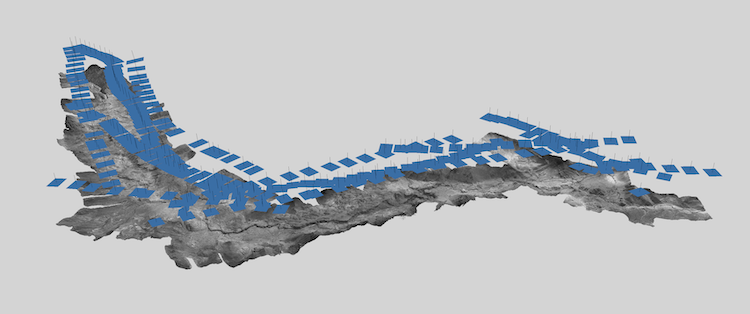
GeoPACHA is a browser-based platform for viewing, mapping and documenting Andean archeological sites using satellite and historical aerial imagery from survey flights dating back to the 1930s. Using the advanced computational resources of the Spatial Analysis Research Laboratory and the Vanderbilt Initiative for Interdisciplinary Geospatial Research Trans-Institutional Program, these aerial photos, purchased through a grant from the Vanderbilt Data Science Institute, can be processed into high resolution, map-correct mosaics. GeoPACHA then displays these along with high-resolution satellite imagery to enable a “virtual archaeological survey” over very large areas of the central Andes.
Using these sources, trained teams of students and researchers are now compiling locations of thousands of archaeological sites on GeoPACHA, some of which are now completely lost from the effects of climate change, development, natural disasters and looting. Over the long term, they plan to use these manually documented sites as training data for an AI-assisted approach to survey even larger areas.
LOGAR is a complementary repository for primary source information about the planned colonial towns of the Reducción. LOGAR functions as a scholarly crowdsourced index where each town has its own “place page” where all relevant documentary source information is compiled. This is particularly important because no complete copy of the Viceroyalty’s master registry of Reducción settlements is known to have survived to the present day.
Thanks to these two tools, Wernke and his colleagues have been able to compile the most comprehensive maps of the Reducción and locate nearly 80 percent of the Reducción towns believed to have existed. In their study, they analyzed the towns’ distribution in relation to the infrastructure of the Inka Empire—especially its imperial road system—and found a striking correlation. These big-picture patterns reveal how Spanish colonial schemes were not imposed upon, but rather entangled with the stuff of local communities and Inka administration.
“A big-picture view does not mean a top-down view,” said Wernke. “Through GeoPACHA and LOGAR, we can start to see how the ground plan of the empire was really an emergent property of thousands of local negotiations.”