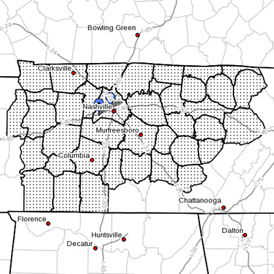
The National Weather Service has issued a special weather statement regarding the high temperatures expected to impact much of Middle Tennessee in the coming days.

The NWS says triple-digit temperatures will begin Thursday and continue through the weekend, with no significant chances of rain in sight.
A large dome of high pressure is forecast to build eastward out of the Great Plains and move across the Tennessee Valley. High temperatures west of the Cumberland Plateau, including the Nashville area, will continue to warm into the upper 90s on Thursday, with highs between 102 and 104 degrees by Friday afternoon.
These triple-digit temperatures will near the record. A forecasted high of 101 degrees in Nashville on Thursday is just 3 degrees shy of the record of 104 set in 1952. This will be the first triple-digit heat in Nashville since Aug. 3 of last year, when the thermometer hit 102 degrees.
Friday, a high of 103 degrees is forecast, which would tie the 60-year record of 103 set back in 1952. A record high temperature of 106 degrees, set on June 30, 1952, is the hottest temperature ever recorded in Tennessee in the month of June.
Hot weather safety will be very important this week, so follow these simple tips:
- Avoid long-term exposure to the heat by remaining indoors during the hottest part of the day.
- If you have to be outside in the heat, slow down, drink plenty of non-alcoholic fluids, and wear lightweight, loose-fitting clothes.
Rainfall across Middle Tennessee continues to be well below normal, with many areas now in a moderate to severe drought. Farmers and gardeners are much in need of rain, and area lakes are below normal levels. The driest areas have been across Northwest Middle Tennessee and in the Southeast. There is no significant rain in the forecast through July 4.
Contact: Johnny Vanderpool, VU emergency preparedness coordinator
johnny.vanderpool@vanderbilt.edu