Metropolitan Nashville Public Schools has joined with the Vanderbilt Center for Nashville Studies and Peabody College to create a platform to provide detailed, reliable and recurring information about the commitment of major employers to the public school system. This is the latest installment in a series that tells the story of collaborative involvement between members of the Vanderbilt community and local public schools.

Through a partnership between Vanderbilt and Metro Nashville Public Schools, a group of dedicated teachers returned to the classroom this year with a new skill set and the tools to incorporate GIS mapping technology into their curriculum.
“There are lots of students who may be good students, but they just need an outlet,” explained workshop leader Janey Camp, research assistant professor in environmental engineering. “They need to find a way to know something in a different way.”
A visual learner herself, Camp is passionate about bringing nontraditional modes of learning into the K-12 classroom. “It’s something that’s important and I care about. I love working with the teachers. If they do circle back and ask for help in the classroom, I go do that, too,” she said.
Camp, who serves on advisory boards for the Academies of Nashville at two local high schools, first got involved in Metro classrooms as a Vanderbilt graduate engineering student through the Vanderbilt Center for Science Outreach (CSO).
She noticed that GIS technology is a tool that students “seem to get and really enjoy,” but it often takes a bit more time and training for teachers. While a yearlong study would be ideal, Camp’s mission is to quickly improve the teachers’ confidence in using the tool in just a few short sessions.
GIS (or geographic information systems) is a kind of geospatial technology employing spatial data. Some of that data is gathered using GPS, or global positioning systems. It is used to help visualize, analyze and model the world. GIS tracking often is associated with climate change studies and watershed management, for example. But it also has applications for business development, and it can help organizations make informed decisions.
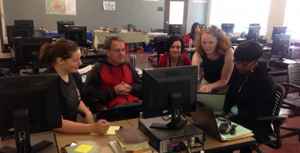
During a summer workshop held at Metro’s Martin Professional Development Center, teachers spent time in the computer lab during the morning and then put the tools to work in an afternoon exercise measuring the space devoted to sports facilities in Nashville. They also used the tool to analyze the placement of tornado warning sirens around the Nashville community.
Camp trained the teachers in the summer workshop on the ArcGIS desktop tool used for creating, mapping and managing geographic information. A cloud-based collaborative content management system, the online version of ArcGIS is free.
“I am lacking computer skills, so this is very helpful to me,” Mark Moses said during the workshop. He teaches algebra in the Academy of Health Science at John Overton High School. “I have a couple of periods of geometry, so I am looking forward to learning what they can do with this to make geometry more meaningful to them.”
Camp noted that GIS isn’t just for STEM (science, technology, engineering and math) subjects. GIS tools are useful for story mapping and community-based projects. For teachers of literature, GIS can aid students visualizing Odysseus’ exhausting journey in The Odyssey or chronicling authors’ biographies.
That will be true for Savannah Keef’s freshman English students at Overton High this year. They will study The Odyssey by Homer, Shakespeare’s Romeo and Juliet, I Know Why the Caged Bird Sings by Maya Angelou, and It’s a Long Way Gone: Memoirs of a Boy Soldier by Ishmael Beah.
“My theme is around ‘how can I give back to my community? How can I share truth?’ I want my students to ask how they can become involved with the community to change it for the better,” Keef said.
Keef also envisions geo-mapping as part of a community-based senior capstone project. “I love the mapping because the students can pick parts of the community they want to work on,” she said. “It can be very student-centered, and ultimately it’s about them figuring out who they are.”